


GeoAddIn
The map add-in PowerPoint should have shipped with
GeoAddIn 이란?
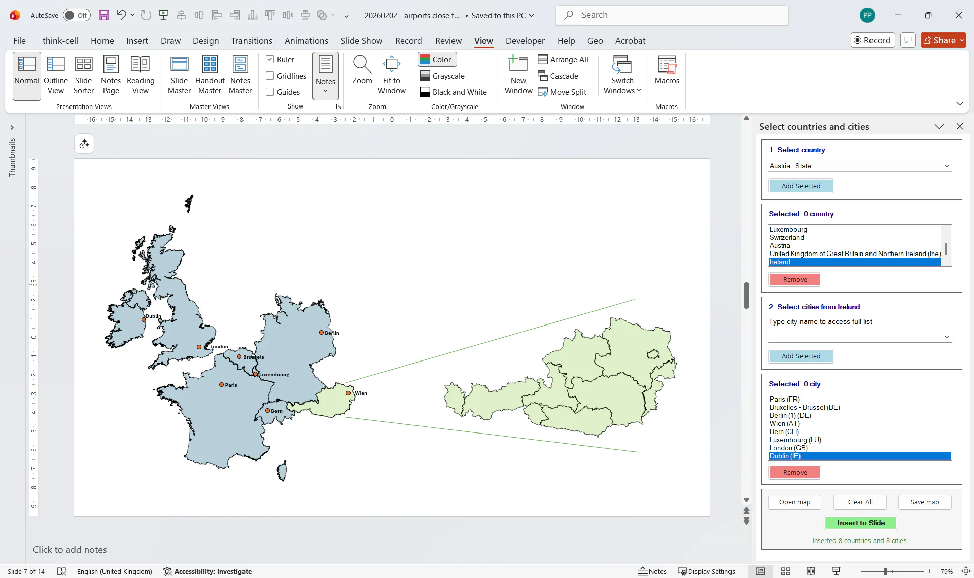
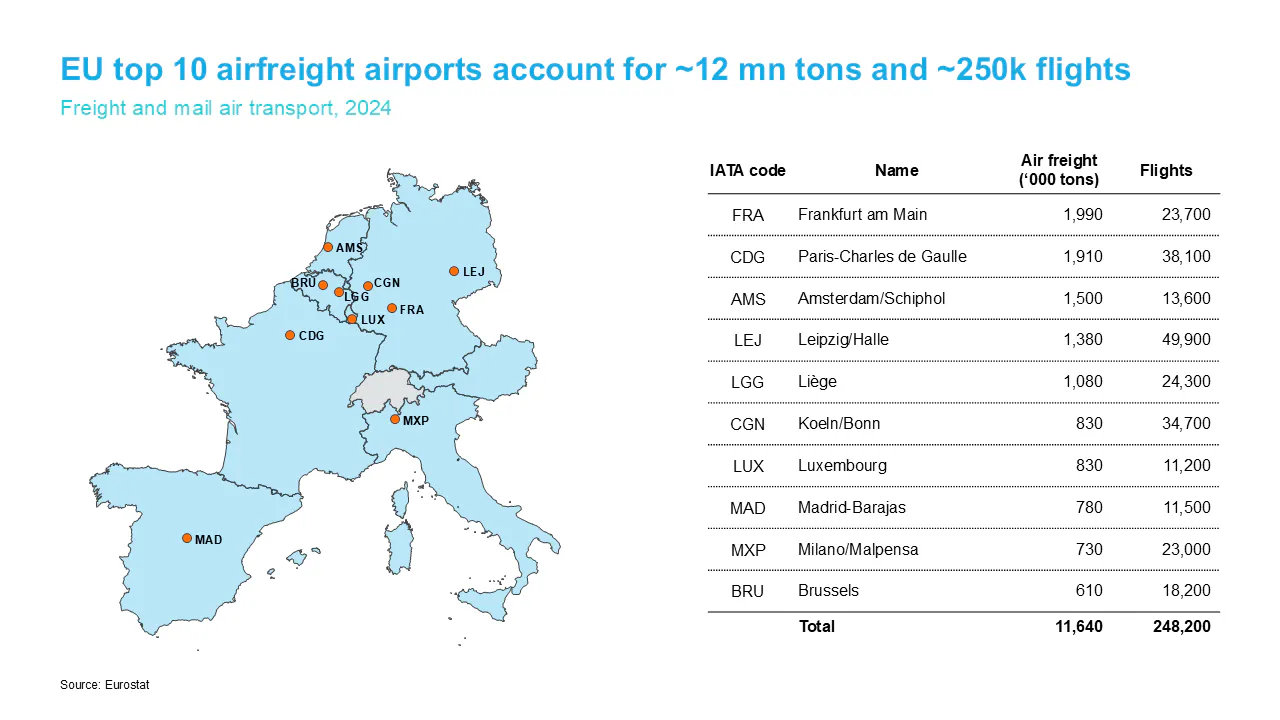
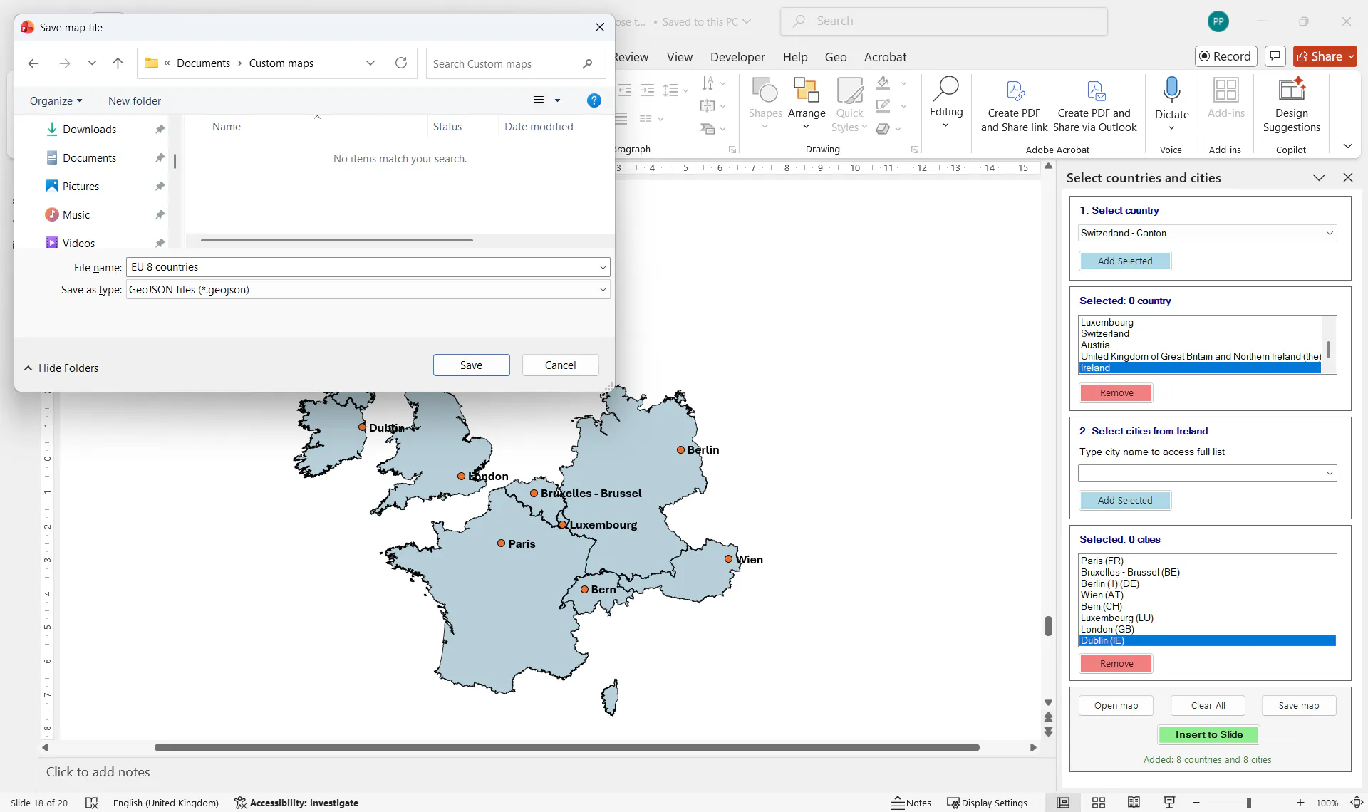
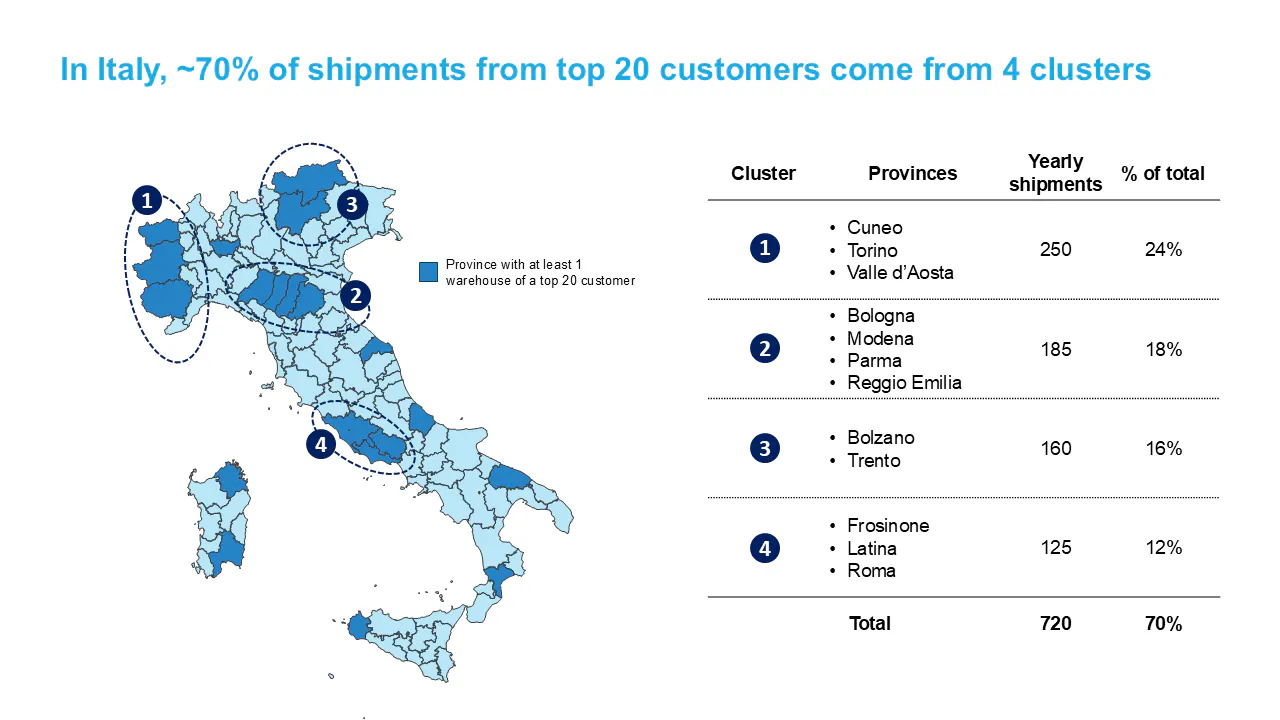
GeoAddIn inserts maps directly into PowerPoint as native shapes. They are fully editable, recolorable, animatable, and shareable with anyone (no add-in required to view or edit). 40+ European territories covered. Add country subdivisions (up to 3rd level), city markers, and airports by IATA/ICAO code. Works offline. No screen capture. No other software. Just PowerPoint.
스크린샷
?
아직 댓글이 없어요. 가장 먼저 남겨보세요!
GeoAddIn 에 대한 X의 실제 대화
X에 게시