


GeoAddIn
The map add-in PowerPoint should have shipped with
GeoAddIn とは?
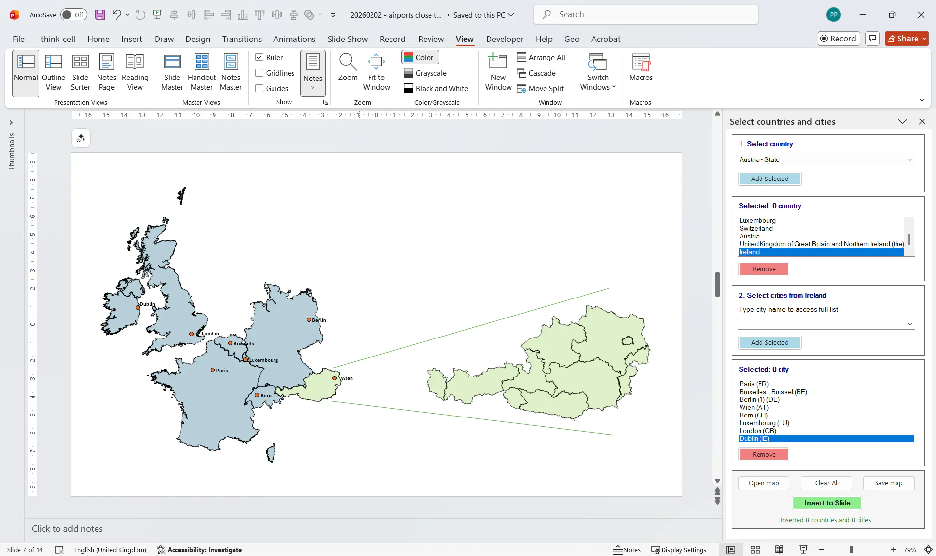
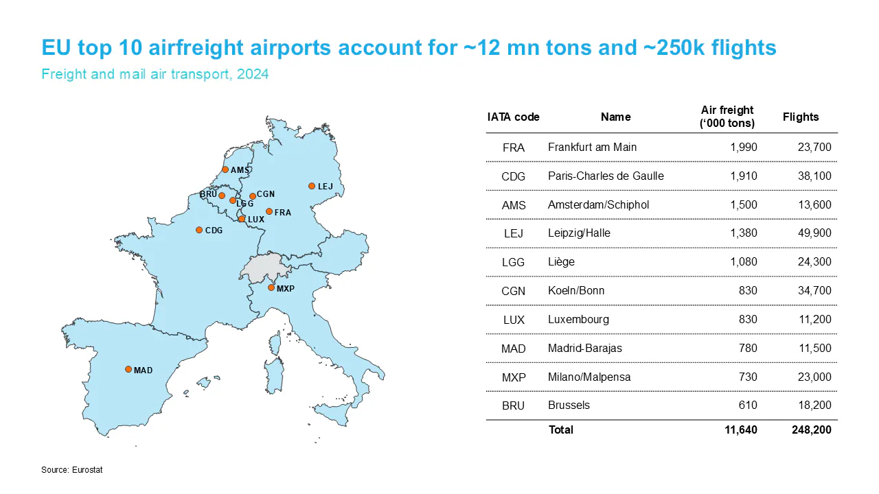
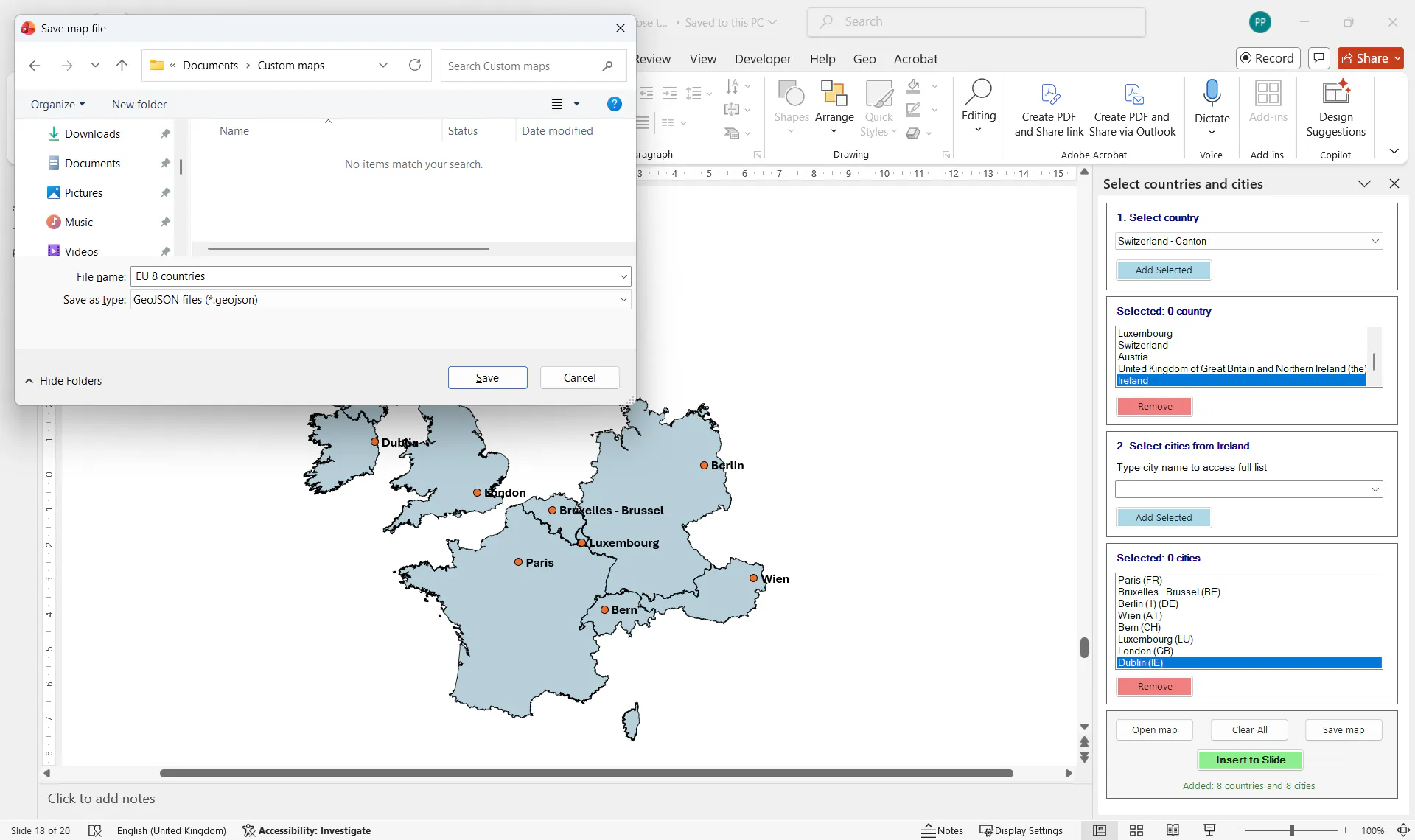
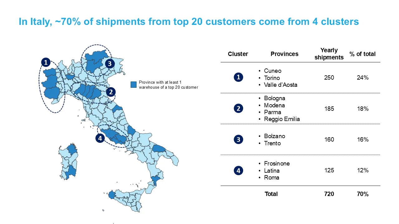
GeoAddIn inserts maps directly into PowerPoint as native shapes. They are fully editable, recolorable, animatable, and shareable with anyone (no add-in required to view or edit). 40+ European territories covered. Add country subdivisions (up to 3rd level), city markers, and airports by IATA/ICAO code. Works offline. No screen capture. No other software. Just PowerPoint.
スクリーンショット
?
まだコメントはありません。最初のひとりになりましょう!
GeoAddIn に関する X でのリアルな声
X に投稿